Map Generator Tab
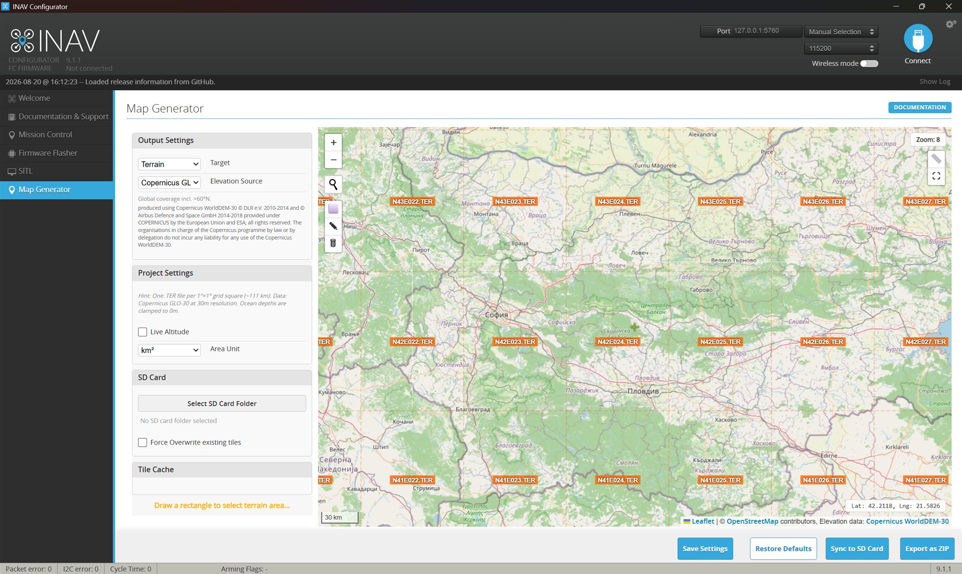
The Map Generator tab creates the .TER terrain elevation files that feed INAV's terrain system, including Terrain AGL Hold. It can also make offline map tiles for radio mapping widgets. The tab works without a flight controller connection. Select a target, draw an area on the map, and sync the output to an SD card or export it as a ZIP.
Targets
| Target | Output | Goes to |
|---|---|---|
| Terrain — see Terrain AGL Hold | .TER elevation files | Flight controller SD card |
| b14ckyy ETHOS Mapping Widget | Map tiles | Radio SD card |
| Yaapu Telemetry Widget (ETHOS / EdgeTX) | Map tiles | Radio SD card |
Generating terrain files
- Select Terrain as the target. The map switches to a 1°×1° grid overlay with the
.TERfile names. - Pick the Elevation Source. Copernicus GLO-30 is the default.
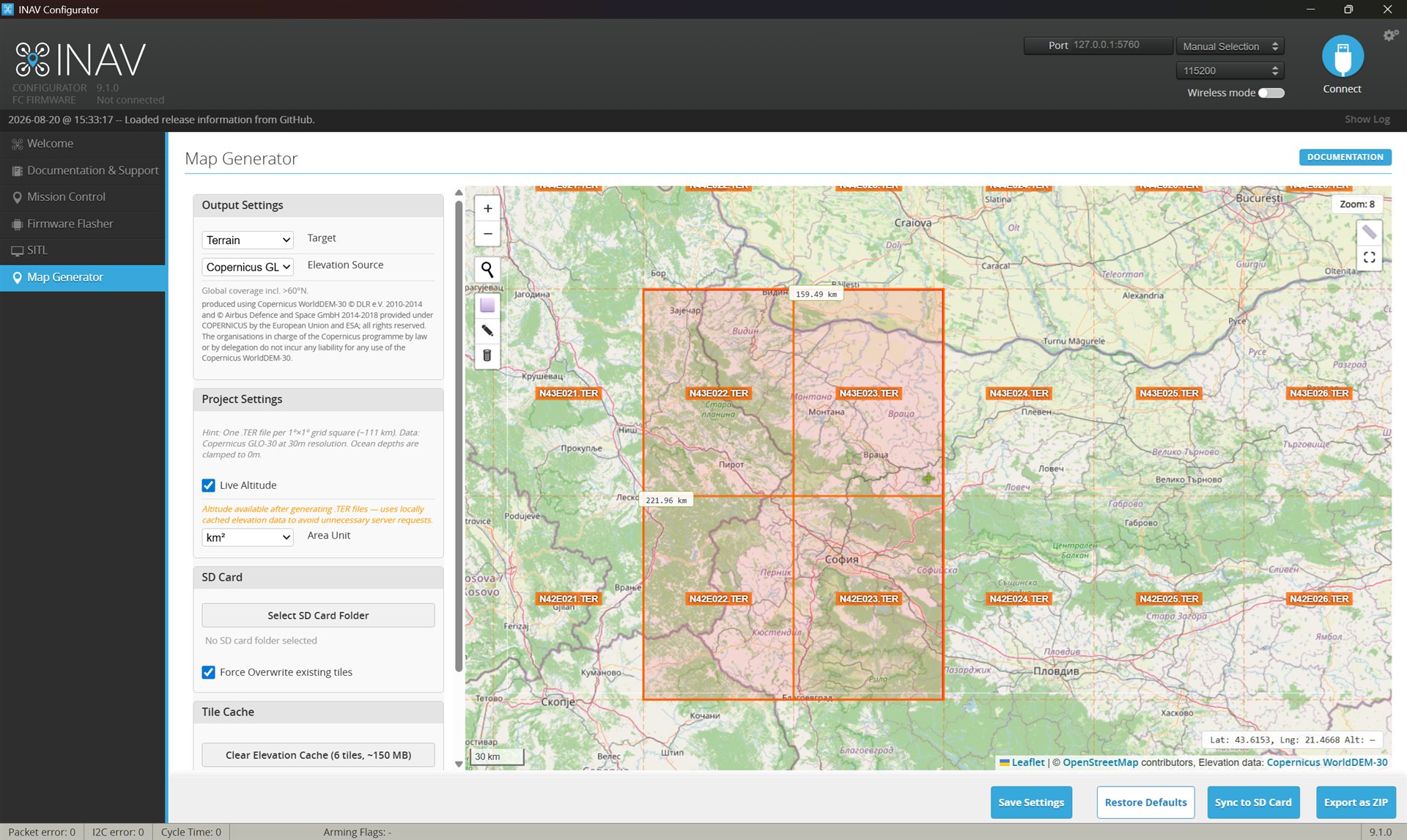
- Draw a rectangle over your flying area. The status shows which
.TERfiles will be generated and their estimated size. Make sure the tile for your take-off site is in the selection. INAV reads the home tile first, and without it no terrain data is shown at all. - Link your SD card folder, or use Export as ZIP.
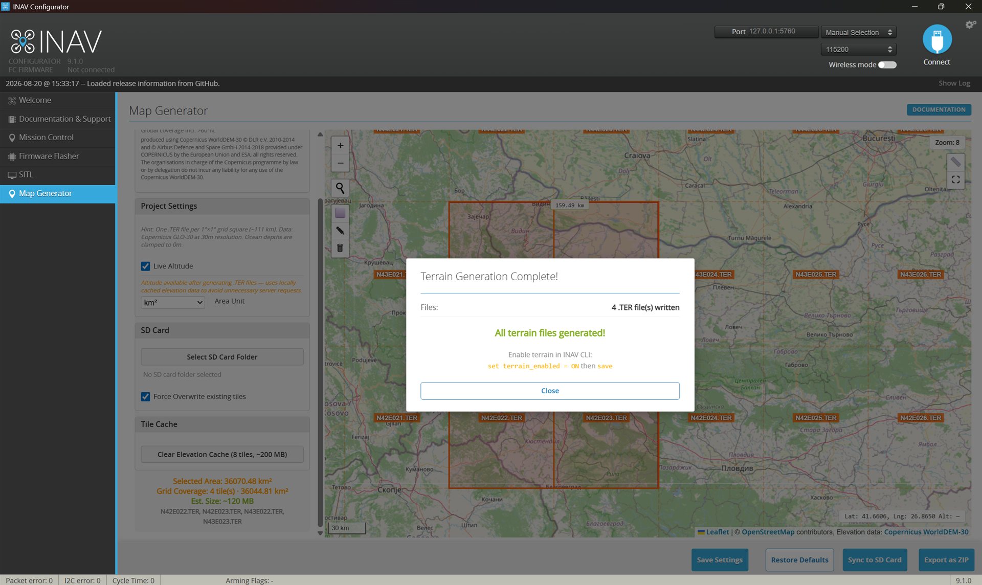
- Click Sync to SD Card. The elevation data is downloaded, converted to
.TERand written to the card. - Enable terrain in the INAV CLI:
set terrain_enabled = ONthensave.
The SD card
- For a new terrain installation, format the card first. Use the SD Memory Card Formatter, not the Windows format dialog. A freshly formatted card has no
FREESPAC.Efile yet, INAV makes one on the first boot. - If you write to a card that has already been used in the flight controller (adding a tile for a new area, replacing files), delete the card's
FREESPAC.Efile first. The Sync to SD Card button does this automatically, so only manual copying needs it done by hand. INAV makes a fresh one on the next boot. The tab shows these reminders as well. - The fastest way to write the files is an external SD card reader. INAV's MSC mode (the flight controller mounted as a USB drive) works too, but it is very slow.
- Use a quality SD card. Cheap cards can cause read errors in flight.
The data
| Detail | Value |
|---|---|
| Source | Copernicus GLO-30 (default) or NASA SRTM1 |
| Resolution | 1 arc-second (about 30 m) |
| Output | One .TER file per 1°×1° square (about 111 km), around 30 MB each |
| Coverage | 84°N to 90°S (Copernicus), 60°N to 56°S (SRTM) |
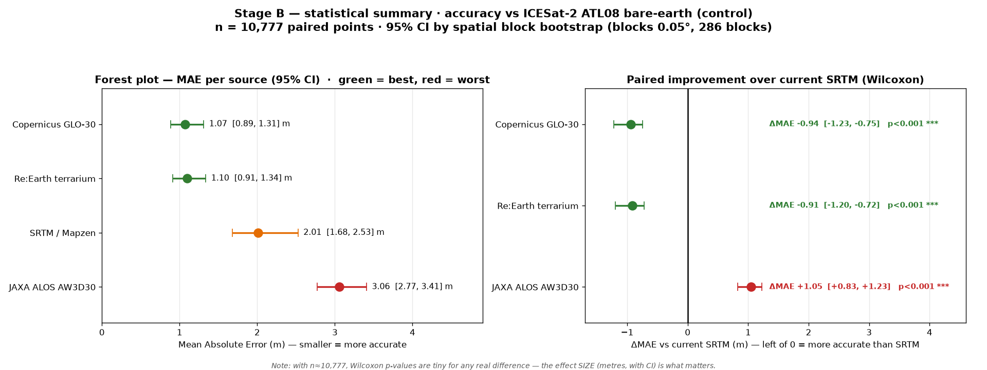
Copernicus is the default because it is about twice as accurate on bare earth (mean error around 1 m versus 2 m for SRTM, measured against ICESat-2 satellite laser ground truth) and because it covers latitudes above 60°N, where SRTM has no data. The .TER format is identical for both sources. If the Copernicus service cannot be reached, the Configurator asks before falling back to SRTM. The full accuracy methodology and numbers are in this PR comment.
Good to know
- Downloaded elevation data is cached locally. Repeat generations reuse it, and the two sources are stored separately, so they never mix.
- After generation, hover the mouse over the map to see the elevation under the cursor.
- Files already on the SD card are skipped, unless Force Overwrite is checked.
- Ocean depths are clamped to 0 m.
- The tab can also search locations by name, measure distances on the map, safely eject the SD card, and save your settings across sessions.
Radio map tiles
The other two targets make offline map tiles for the b14ckyy ETHOS Mapping Widget and the Yaapu Telemetry Widget. Pick the widget, pick a map provider, draw the area, and sync to the radio's SD card. The provider list, the MapTiler key setup and the output paths are described in the Configurator README.